NASAが新たな木星画像を公式サイトに掲載しています。
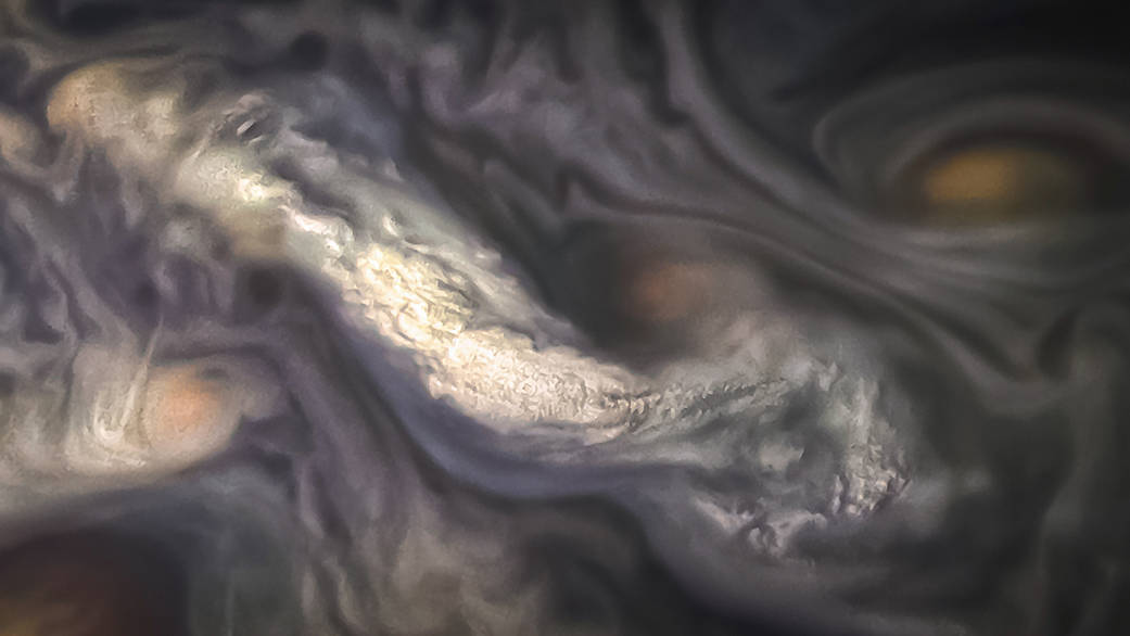
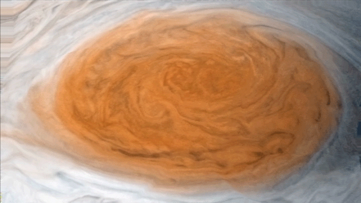
木星大気の非常に高い高度における雲の形成を捉えた画像です。
ただし、これはNASAが公開しているジュノーカムの生画像データを民間人が画像処理して「作成」したものです。
NASAのオリジナル記事と和訳
This image captures a high-altitude cloud formation surrounded by swirling patterns in the atmosphere of Jupiter’s North North Temperate Belt region.
この画像は、木星の北半球の温帯にある渦巻きに囲まれた帯状の大気における高々度の雲の形成を捉えたものです。
The North North Temperate Belt is one of Jupiter’s many colorful, swirling cloud bands. Scientists have wondered for decades how deep these bands extend. Gravity measurements collected by Juno during its close flybys of the planet have now provided an answer. Juno discovered that these bands of flowing atmosphere actually penetrate deep into the planet, to a depth of about 1,900 miles (3,000 kilometers).
北半球の温帯にある帯状の大気は、木星の多くの色とりどりの渦巻き雲の一つです。科学者たちは、これらの帯状の大気がどのくらい深くまで広がっているかについて何十年も分からずにいました。ジュノーが木星に最接近した際に重力観測器で測定した結果から、今では答えが分かっています。ジュノーは、流動している大気の帯が約1,900マイル(3,000キロメートル)の深さで木星内部の深部まで浸透していることを明らかにしたのです。
NASA’s Juno spacecraft took this color-enhanced image at 10:11 p.m. PDT on July 15, 2018 (1:11 a.m. EDT on July 16), as the spacecraft performed its 14th close flyby of Jupiter. At the time, Juno was about 3,900 miles (6,200 kilometers) from the planet’s cloud tops, above a latitude of 36 degrees.
NASAの木星探査機ジュノーは、この画像処理された元の画像を14回目の木星最接近にあたる 2014年7月15日10時11分(PDT)(7月16日午前1時11分(EDT))に撮影しました。当時、ジュノーは木星の緯度36度の大気の雲頂から約3,900マイル(6,200キロメートル)離れた地点に位置していました。
Citizen scientist Jason Major created this image using data from the spacecraft’s JunoCam imager.
民間の科学者Jason Majorは、この画像を探査機に搭載されているジュノーカムの生データを使用して作成しました。
JunoCam’s raw images are available for the public to peruse and process into image products at https://missionjuno.swri.edu/junocam/ .
More information about Juno is at https://www.nasa.gov/juno and http://missionjuno.swri.edu.
Image Credits: NASA/JPL-Caltech/SwRI/MSSS/Jason Major
Last Updated: July 21, 2018
Editor: Jon Nelson
